
When Cyclone Gabrielle struck Tairāwhiti in 2023, the impacts were immediate and visible. Rivers carried vast quantities of forestry slash downstream, damaging infrastructure, burying land, and affecting communities. The scale of the event prompted a ministerial inquiry and a set of recommendations aimed at reducing future risk. That response acknowledged the problem, but the current trajectory raises a broader question.
What changes is not the recognition of risk, but the extent to which it is embedded in practice. The inquiry identified clear drivers of damage, including large clear-cut areas, insufficient spacing between harvests, and exposure of vulnerable slopes during key periods. Recommendations were made to limit harvest size, introduce green-up periods, and reduce catchment-level exposure. Taken together, these measures were intended to reduce the likelihood of similar downstream impacts.

In practice, implementation appears uneven. Analysis of recent consent decisions suggests that large harvest areas continue without explicit limits, and high-risk zones such as gullies and headwaters are not consistently excluded. At the same time, proposed changes to national standards would allow more flexibility in lower-risk areas while constraining the ability of councils to impose stricter controls. The system continues to operate, but the structure within which decisions are made has not shifted in line with the identified risks.
This shifts the focus from response to consequence. Forestry operations occur upstream, but the effects are carried into rivers and onto downstream land. Where controls do not reflect the physical behaviour of catchments, the risk remains. Rivers respond to gravity, rainfall, and accumulated material, not to administrative boundaries or guidance documents.
The wider pattern is not unique to this event. Large-scale natural events expose underlying system behaviour rather than creating it. Where the same conditions remain, similar outcomes are likely under comparable stress. The question is not whether another storm will occur, but how the landscape will respond when it does.
The principle is straightforward. Identifying risk is not the same as reducing it. Where recommendations do not translate into consistent limits and practice, the system retains the same vulnerabilities.
This is not about forestry in isolation. It is about how land use decisions interact with river systems, and whether those interactions are managed in a way that reflects known risks.
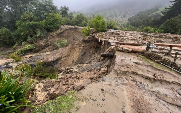
See https://www.rnz.co.nz/news/national/484213/widespread-damage-cyclone-gabrielle-in-pictures