After the latest bout of wild weather, the phrase “new normal” has been repeated frequently. Severe storms, intense rainfall, flooding, slips, power outages - all described as if they represent something unprecedented in New Zealand’s history.
But are they?
A quick look backward suggests a more nuanced story.
A long memory of rough weather
New Zealand has always lived at the meeting point of volatile weather systems. We sit in the path of deep Tasman lows, transitioning tropical cyclones, and powerful southerlies funnelled through mountain ranges.
History records plenty of severe storms long before modern headlines:
- The Wahine storm of 1968, with hurricane-force winds in Wellington and widespread damage.
- Cyclone Bola in 1988, bringing days of torrential rain to the East Coast, washing out bridges and farms.
- The twin impacts of Fergus and Drena in the late 1990s.
- Major Wellington storms in the 1970s that triggered extensive slips and flooding.
- Earlier still, devastating storms in the 19th and early 20th centuries that wrecked ships and isolated communities.
New Zealand has never been meteorologically gentle.
Old newspaper archives are full of familiar language:
“Worst in living memory.”
“Unprecedented flooding.”
“Roads impassable.”
What has changed is not necessarily the existence of severe storms - but what lies in their path.
A country more exposed
In 1926, New Zealand’s population was about 1.4 million.
Today it is more than 5 million.
That increase alone changes the scale of impact.
Areas that were once farmland, wetlands, or sparsely populated river flats are now:
- housing subdivisions,
- arterial roads,
- industrial estates,
- fibre corridors and utilities,
- high-value coastal properties.
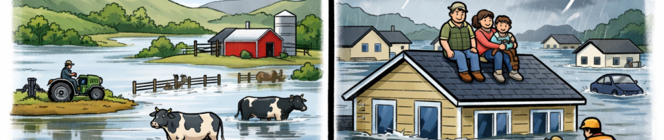
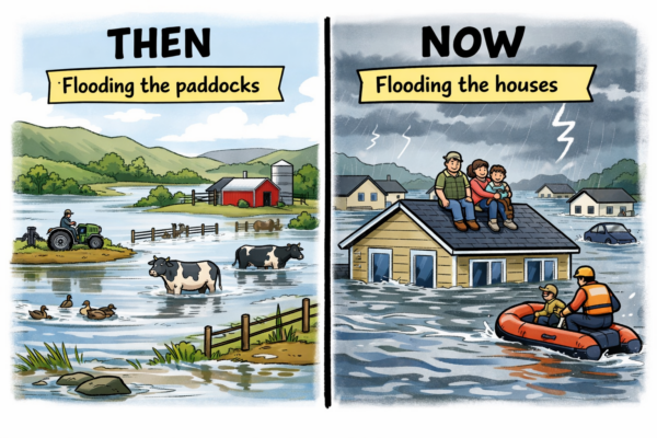
Storms that once flooded paddocks now flood living rooms.
Building where earlier generations hesitated
Earlier settlers often avoided:
- low-lying floodplains,
- unstable slopes,
- reclaimed harbour margins.
Modern development has been less cautious. Pressures for housing and growth have pushed construction into areas that are naturally dynamic - river mouths, steep hillsides, coastal edges.
When heavy rain falls on:
- hard surfaces instead of pasture,
- compacted soils instead of wetlands,
runoff increases dramatically. Peak flows rise. Slips become more likely.
The rainfall may not be new. The consequences are.
Infrastructure built for another era
Much of New Zealand’s:
- stormwater systems,
- culverts,
- bridges,
- wastewater networks,
were designed decades ago.
They were built for:
- smaller populations,
- lower property values,
- different assumptions about development intensity.
When those systems are stressed today, the failure is not only hydraulic - it is financial and social. A washed-out bridge now disrupts thousands of commuters. A wastewater failure closes marine reserves and beaches. A blocked culvert floods homes worth millions.
Storms reveal deferred maintenance as much as they reveal rainfall totals.
The illusion of novelty
Modern media also changes perception.
Drone footage, live reporting, and instant national coverage amplify every event. In earlier decades, severe weather could devastate a region and remain largely regional news.
Today, every landslip becomes a national story.
That visibility can create the impression that storms themselves are new, rather than our exposure to them.
The harder question
If storms are not new, then the more uncomfortable question is this:
Have we planned and invested appropriately in a country that has always had severe weather?
New Zealand’s geography guarantees:
- steep terrain,
- narrow valleys,
- short, flashy rivers,
- exposed coastlines.
Resilience in such a landscape requires:
- cautious land-use decisions,
- robust infrastructure,
- long-term maintenance discipline.
It is easier to describe events as unprecedented than to examine decades of planning choices.
Outdoor users notice patterns
For those who spend time outdoors - hunting, fishing, tramping, boating - severe weather is part of the landscape. Rivers rise. Tracks wash out. Slopes move.
But many long-time observers would agree: storms are not a new feature of New Zealand life.
What feels different is how many people, homes, and assets now sit in places earlier generations treated with caution.
A more grounded perspective
None of this minimises the hardship severe storms cause. Families displaced, roads destroyed, livelihoods interrupted - those impacts are real and immediate.
But describing each event as an unprecedented new reality risks distracting from practical questions:
- Are we building in the right places?
- Are infrastructure systems being renewed fast enough?
- Are planning decisions adequately accounting for known risks?
- Are we investing in resilience rather than assuming benign conditions?
Storms will continue to test New Zealand. They always have.
The question is not whether severe weather is new.
The question is whether we have made ourselves more vulnerable to it.
My connection to Westland goes back to 1991. I traveled SHWY 6, or up and down connected valley roads as a vet. I retain a property in South Westland as a base for the hunting and fishing. There have been massive slips and flooding over this period, but to my mind the scars from slips that face the highway and the loss of grassy river benches that held the odd deer in spring has increased. As a visiting American geologist remarked; “Its like they are still building this place!”
Andi’s article makes a good point, that too much “recent” development has occurred in areas that were long known to hold risks of flooding or coastal erosion.
Some people are natural explorers with a keen eye and a natural inquisitiveness about the world around them. I’m one of them, lucky enough to be introduced to New Zealand’s backcountry by some experienced mountaineers and bushmen. They knew about glaciers, mountains and valleys and explained to me how they were formed. I became a keen tramper, hunter, biologist, geologist. If I understand anything, I understand how natural things work and how they got to be there. New Zealand is “a land uplifted high” to quote the title of a book about New Zealand’s mountains by John Pascoe. Geologists have discovered that New Zealand’s mountains have uplifted 60,000 feet during their geological history, fault lines have shifted our Southern Alps about 600 kilometres sideways, the rocks in Northwest Nelson matching those in Fiordland, little by little, one earthquake at a time, fault lines everywhere. There is only one place for “a land uplifted high” and that’s downhill, transported by water, earthquakes and / or volcanoes. It doesn’t matter how much vegetation grows on our hill sides eventually the ground will slide downhill, often assisted by heavy rain or earthquakes. It sickens me the way people blame Forestry Companies and Councils for landslips because they have cut down trees and loosened soil. The same for people who think that wild animals eating vegetation and trampling the soil will cause landslips. They simply have no idea about the power of natural processes. Hydrologists have discovered that the sediment loads in rivers are directly proportional to rainfall, that means there is about 6 times more clay, sand and gravel transported down our West Coast Rivers than our East Coast Rivers. The idea that human beings are responsible for weather extremes, landslides, floods etc is fanciful, plain ignorant. Sure, we can build stop banks to stop the bigger floods but eventually nature will always win, there will be a perfect storm, a combination of high rainfall, high tides, earthquakes etc. So be careful where you build your houses, choose high ground and work out where the dangers are, talk to people who have spent a long time in your district.
Two good comments. Look at Napier, which had a massive earthquake in 1931 and raised the land around the airport and suburbs Onekawa, Marewa, Tamatea, etc. So the council allowed suburbs to spread over this uplifted land. Dumb!
What happens if another earthquake happens and pushes the land down under sea level again?
Point is much of the damage has occurred because of building on flood plains. A lack of foresight.
Extreme weather events with storms and droughts have always been here.
Nineteenth century missionary-explorer William Colenso encountered storms so fierce they wrecked the vegetation on the Ruahine Ranges. His diary described giant land slips down which it “was fearful to look” and dead trees from previous storms.
Dr Patrick Grant, botanist and hydrologist of Hawkes Bay, researched it and identified cyclic weather patterns involving weather extremes back to the 16th century. For instance he identified a succession of several very dry years culminating in a massive drought about 1915-16 that stressed and killed giant forest trees. The Kawekas were similarly affected.
The extreme greenies blamed in on deer and possums. It wasn’t – it was natural climate cycles characterised by extreme weather ranging from storms to droughts.
Dr Grant wrote an excellent book “Hawkes Bay Forests of Yesteryear”. It’s very worth reading.
How come all the experts can’t see the common sense written in this article and the comments above.
Whether there has been an increase or not in storm related damage, everything is pointing at the need for a). more investment in hardening infrastructure and b). better informed town planning in terms of where development happens (that or property owners sign a waiver that the taxpayer is not responsible for compensating them for building in a silly spot). NZ Inc has no ability to change weather or the climate etc. but we can choose to adapt. Last point – maybe some areas (looking at you East Coast) are just too expensive/vulnerable to keep alive; maybe “planned retreat” means shooting the wounded…
Check out the number of one in a hundred year events in recent years …….. it’s been one every year usually in East Coast, Hawkes Bay, Nelson and Canterbury. All of these are areas with massive destruction of the natural vegetation on the hills and in the wetlands. Natural vegetation that took 70 million years to “perfect” itself.